Maps and cycling guides on the Velodyssey
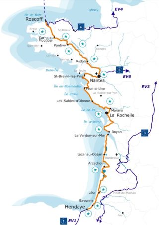
Where does the Vélodyssée start ? The itinerary stretches over 1200 km between Roscoff and Hendaye. The cycle route crosses Brittany and follows the Atlantic coast to the Basque coast. The Vélodyssée is an excellent choice for a first cycling trip because its level of difficulty is low and the route is safe.
Cycling on the Velodyssey
The La Vélodyssée project has been a great success with tourists in recent years with 70% of its trails developed and its many natural and heritage sites. Its low level of difficulty makes it a popular destination for families on vacation.
The Vélodyssée, the largest bicycle route in France
The Atlantic coast cycle route is part of the Eurovelo 1, an 11,000 km route between Norway and Portugal. Eurovelo 1 is still in development. The Vélodyssée runs along the Atlantic coast between Nantes and Hendaye, between Nantes and Carhaix, the Canal de Nantes à Brest crosses your path before reaching Roscoff.
Get the maps and cycling guides on the Vélodyssée on Cartovelo.